GEOLOGICAL SOCIETY OF NEW HAMPSHIRE
  • Home
    • GEO-Mapper
    • Dinner Meetings
    • Field Trips
    • Publications >
      • Back Issues GSG
      • Back Issues NHCPG
      • Submission Guidelines
  • Legislative Update
  • Outreach Activities
    • Lincoln R. Page Fund
    • Classroom Grant
    • Geologist Licensing
    • Continuing Education
    • Job Listings
  • GEO Links
  • About GSNH
    • Board / Committees
    • GSNH Constitution and ByLaws
    • Membership
    • GSNH Sponsorship
Welcome to GSNH's new Geo-Sites Mapper! 
Our goal is to provide you with locations and information on geologically-interesting sites across the state. Please consider this mapper UNDER CONSTRUCTION as we will be adding more sites. 

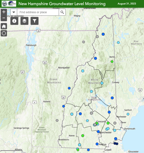
NH Groundwater Level Mapper

Picture
Link to NHGS Groundwater Mapper
​The NH Geological Survey has been collecting groundwater levels at 32 wells, along with USGS well in and near NH for over 20 years. Check out the New Hampshire Groundwater Level Monitoring web application by clicking the image above or HERE.
​​
The most recent state-wide groundwater conditions at the well monitored is displayed on this mapper. The status is currently updated near the beginning of each month. 

NHGS's monthly reports on groundwater well network water levels can be found on NH DESs webpage HERE.  


ARE YOU A MEMBER?
IF NO, SIGN UP TODAY!

CLICK HERE for the Membership Renewal/Application Form 

  • Home
    • GEO-Mapper
    • Dinner Meetings
    • Field Trips
    • Publications >
      • Back Issues GSG
      • Back Issues NHCPG
      • Submission Guidelines
  • Legislative Update
  • Outreach Activities
    • Lincoln R. Page Fund
    • Classroom Grant
    • Geologist Licensing
    • Continuing Education
    • Job Listings
  • GEO Links
  • About GSNH
    • Board / Committees
    • GSNH Constitution and ByLaws
    • Membership
    • GSNH Sponsorship